Map Prints

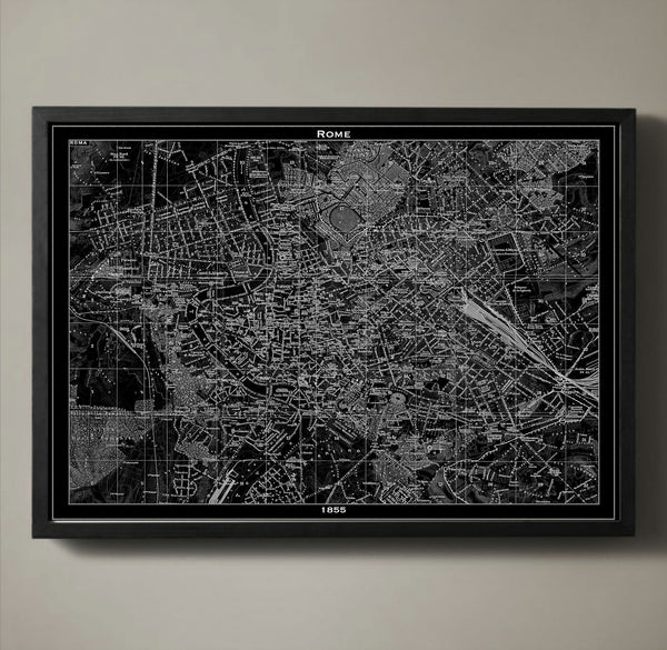
Map Print, ROME
$29.00
Today Rome is a modern urban city, but its long history has been beautifully preserved throughout its streets. Those streets, along with Rome's city blocks, squares, parks, tunnels and bridges are detailed in our 1855 Rome poster map. The Medieval, Renaissance and Baroque times shaped every square inch of Rome, and with our recreation of such an important map you too can admire the city's character. We print all of our poster maps on archival quality stock with a 1/2 inch border around the poster's edge for easy framing.
————————————————————————
Vintage Map Print Sizes Available
18” x 24” $29
24” x 36” $63
36” x 48” $118
Frame not included.
© Copyright 2013 GeoArtShed. Artwork may not be reproduced or resold
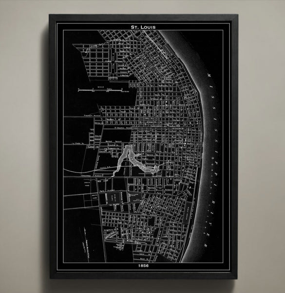
Map Print, ST. LOUIS
$29.00
This vintage 1856 St. Louis map details the city towards the end of its rapid growth between the years of 1840 and 1860. Within those two decades St. Louis grew from a quaint city of 20,000 to a bustling city of 160,000. Our St. Louis city map is printed on premium archival stock with a 1/2 inch border around the map's edges for easy framing.
————————————————————————
Vintage Map Print Sizes Available
18” x 24” $29
24” x 36” $63
36” x 48” $118
Frame not included.
© Copyright 2013 GeoArtShed. Artwork may not be reproduced or resold
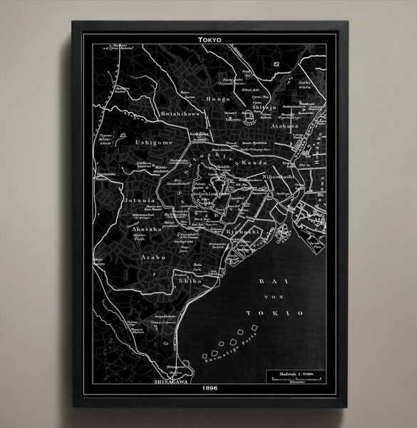
Map Print, TOKYO
$29.00
Today Tokyo is full of skyscrapers, busy streets and neon lights, but back in the 1890s it had an empty skyline, dirt roads and pink blooms that brought natural color to Japan's capital. This Tokyo map print poster is printed on premium archival stock with a 1/2 inch border around the poster's edge for easy framing. Own this distinct map in one of three sizes and in your choice of black or white.
————————————————————————
Vintage Map Print Sizes Available
18” x 24” $29
24” x 36” $63
36” x 48” $118
Frame not included.
© Copyright 2013 GeoArtShed. Artwork may not be reproduced or resold
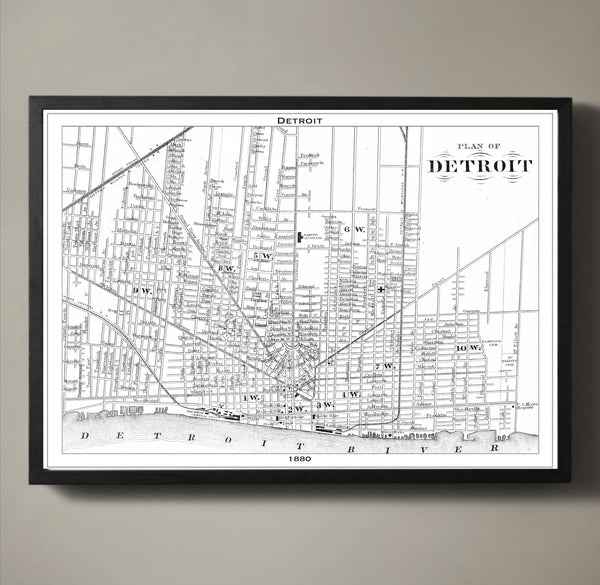
Map Print, DETROIT
$29.00
Today Detroit is the most populated city in Michigan and the largest city on the border of the US and Canada. Back in 1880 Detroit was known as the Paris of the West because of its beautiful architecture. Today Detroit is known for the first automobiles that rolled down its dusty roads and the stamp it had on that industry. What our 1880 map preserves are the iconic Detroit streets walked by men in suits, women in dresses and horses pulling carts. Each block, road, waterway and bridge is captured and preserved on our archival quality stock with a 1/2 inch border around the poster's edge for easy framing.
————————————————————————
Vintage Map Print Sizes Available
18” x 24” $29
24” x 36” $63
36” x 48” $118
Frame not included.
© Copyright 2013 GeoArtShed. Artwork may not be reproduced or resold
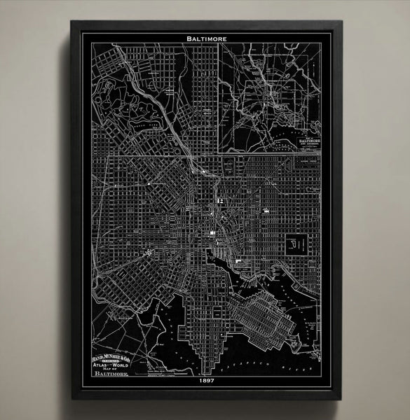
Map Print, BALTIMORE
$29.00
Baltimore is now the largest independent city in America, but back in the 1890s it was only just beginning its journey to greatness. With our black and white variations of this artful 1897 Baltimore map you can own an aerial view of a manufacturing city that was in the midst of its progressive era. Seventy of these blocks would be forever changed in the early 1900s with the Great Baltimore Fire destroying 1,500 buildings. Because of the era in which this map captures its city, it tells the tales of its triumphs and falls; showing a moment in Baltimore's rich history.
————————————————————————
Vintage Map Print Sizes Available
18” x 24” $29
24” x 36” $63
36” x 48” $118
Frame not included.
© Copyright 2013 GeoArtShed. Artwork may not be reproduced or resold
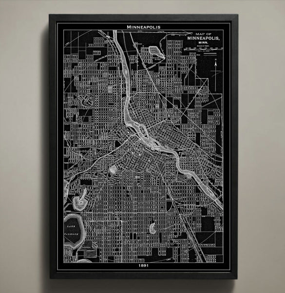
Map Print, MINNEAPOLIS
$29.00
This Minneapolis map print takes a closer look at the famous waterways, streets, bridges, and tunnels that were present there during the late 1800s. Reproduced from a vintage 1891 map, every inch of this city is captured with astounding precision and intrigues the viewer with crevices of the city not normally explored. While Minneapolis, Minnesota is currently the larger of the twin cities at nearly 3.5 million residents, this vintage map reproduction shows the city in a more nascent period when it was still being built upon the commerce of water and wetlands.
The purchase of this listing is for one map print of the city of Minneapolis with the following specifications and options:
Style: Map of Minneapolis, Minnesota (Circa 1891)
Sizes available: 18 x 24, 24 x 36 or 36 x 48 inches
Colors available: Black or white
Materials: 100# premium card stock
Your Minneapolis print does not include a frame but will be mailed to you via USPS First Class in a durable shipping tube. You can return to the GeoArtShed shop home to find more map prints, map posters, or even Minneapolis wall art by following this link:
http://www.geoartshed.com/collections/print-posters-city-maps
© Copyright 2013 GeoArtShed. Artwork may not be reproduced or resold.
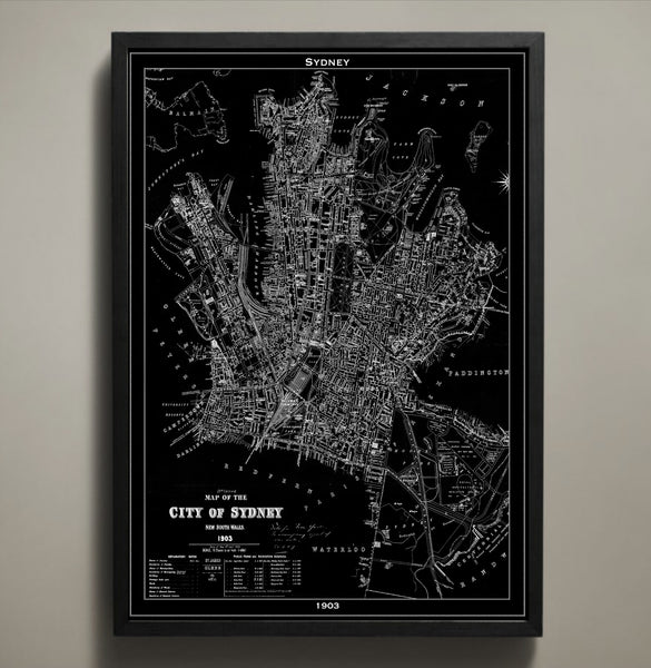
Map Print, SYDNEY
$29.00
The Sydney we know today looked much different in the early 1900s. The streets were unpaved, horse-drawn carriages crossed paths with the 1900s version of public transportation and even with its warm climate both men and women were modestly clothed from head to toe. In our 1903 map the city of Sydney and all of its streets, parks, bridges and squares are contrasted by its large harbor. You can order the Sydney map in several different sizes and printed on archival quality stock with a 1/2 inch border around the poster's edge for easy framing.
————————————————————————
Vintage Map Print Sizes Available
18” x 24” $29
24” x 36” $63
36” x 48” $118
Frame not included.
© Copyright 2013 GeoArtShed. Artwork may not be reproduced or resold
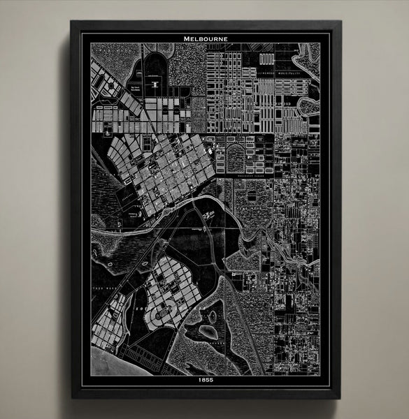
Map Print, MELBOURNE
$29.00
Today Melbourne is a lively neon lit city that attracts visitors from all over the world, but back in the mid-1800s the Australian city wasn't quite the tourist hub we know it to be today. Its streets depicted in our 1855 map would have been filled with people riding horseback, carriages and people covered from head to toe in dresses and pant suites- even in the warm climate. All of our maps are printed on archival quality stock and this particular map is available in both black and white.
————————————————————————
Vintage Map Print Sizes Available
18” x 24” $29
24” x 36” $63
36” x 48” $118
Frame not included.
© Copyright 2013 GeoArtShed. Artwork may not be reproduced or resold
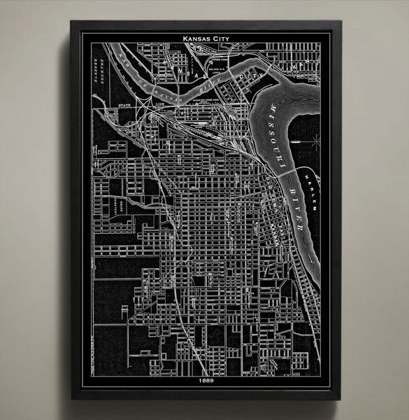
Map Print, KANSAS CITY
$29.00
This map of Kansas City details the stockyards and history of 1889; these stockyards are no more than a memory after being carried away in the cascading waves of the Great Flood of 1951. Now you can travel back in time with this KC poster to take a closer look at the late 19th century structures, streets, and waterways. This map of Kansas City reminds the viewer that this populous place is more than just the home of barbeque, blues, and jazz; it is the home of a rich history of Americana.
The purchase of this listing is for one map print of the city of Kansas City with the following specifications and options:
Style: Map of Kansas City, Missouri (Circa 1924)
Sizes available: 18 x 24, 24 x 36 or 36 x 48 inches
Colors available: Black or white
Materials: 100# premium card stock
Your KC print does not include a frame but will be mailed to you via USPS First Class in a durable shipping tube. You can return to the GeoArtShed shop home to find more map posters, map prints, and Kansas City memorabilia by following this link:
http://www.geoartshed.com/collections/print-posters-city-maps
© Copyright 2013 GeoArtShed. Artwork may not be reproduced or resold.
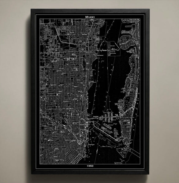
Map Print, MIAMI
$29.00
This is our vintage 1950 Miami map. Our Miami map shows a detailed street grid of the city of Miami. You can clearly see street names, parks, tunnels, bridges, highways and neighborhoods when viewing my prints in person. They look amazing on any wall!
————————————————————————
Vintage Map Print Sizes Available
18” x 24” $29
24” x 36” $63
36” x 48” $118
Frame not included.
© Copyright 2013 GeoArtShed. Artwork may not be reproduced or resold
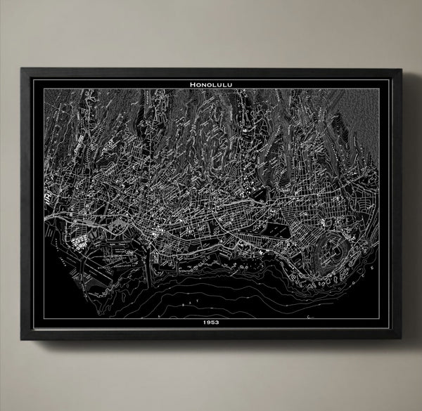
Map Print, HONOLULU
$29.00
Honolulu Map Print. Printed on premium stock using archival ink, this map print will last a lifetime.
————————————————————————
Vintage Map Print Sizes Available
18” x 24” $29
24” x 36” $63
36” x 48” $118
Frame not included.
© Copyright 2013 GeoArtShed. Artwork may not be reproduced or resold
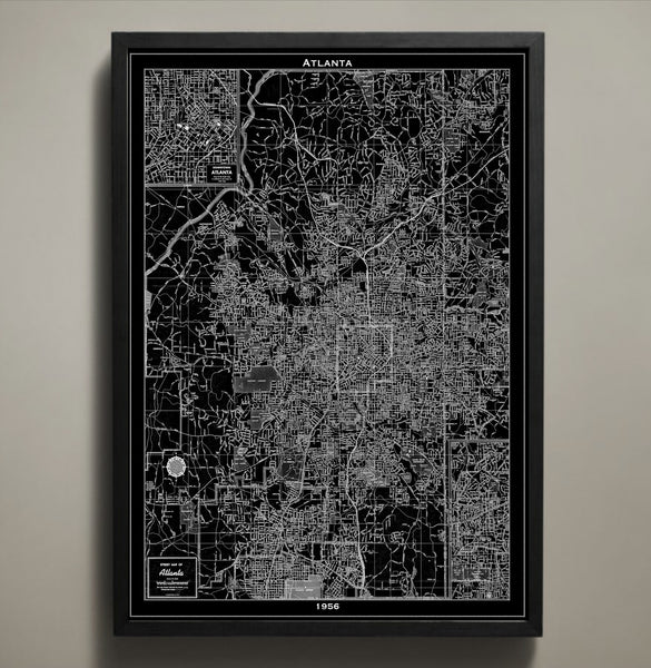
Map Print, ATLANTA
$29.00
Atlanta, Georgia is the land of sweet tea and even sweeter people. Atlanta is steeped in a rich culture and bustling with life and somehow this recreated map print has an uncanny sense of energy that speaks to the magic founds within the city limits. This Atlanta poster is handcrafted using archival stock paper, premium ink meant to last a lifetime, and a detailed eye for each and every side street of this gem of the South.
The purchase of this listing is for one Atlanta poster with the following specifications and options:
Style: Map of Austin, Texas (Circa 1956)
Sizes available: 18 x 24, 24 x 36 or 36 x 48 inches
Colors available: Black or white
Materials: 100# premium card stock
Please note the purchase of this Austin poster does not include a frame but it does detail the rising growth of Atlanta with manufacturing companies and military bases during the 1950s. Your map of Atlanta poster will be mailed via USPS First Class and preserved in a durable shipping tube. If you would like to continue to shop for more map posters, Atlanta home décor, or map prints to use as housewarming gifts you may return to the GeoArtShed by clicking the following link:
https://www.GeoArtShed.com
© Copyright 2013 GeoArtShed. Artwork may not be reproduced or resold.
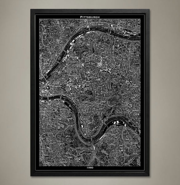
Map Print, PITTSBURGH
$29.00
Map print, Pittsburgh
Our Pittsburgh map print focuses on the eastern side of the city.
————————————————————————
Vintage Map Print Sizes Available
18” x 24” $29
24” x 36” $63
36” x 48” $118
Frame not included.
© Copyright 2013 GeoArtShed. Artwork may not be reproduced or resold
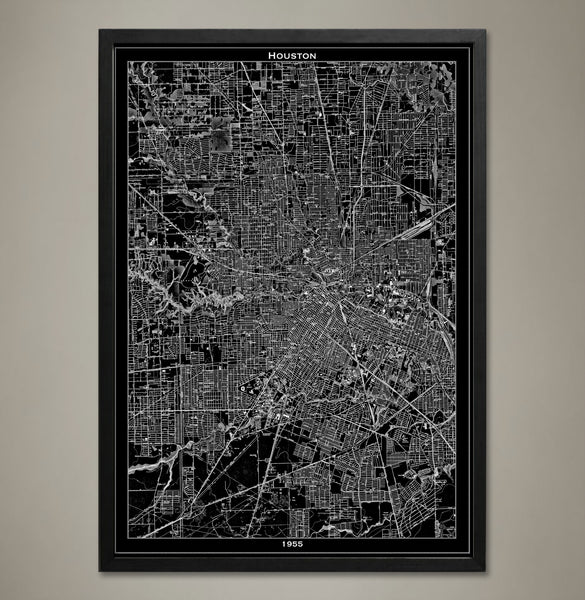
Map Print, Houston
$29.00
This map of Houston revisits a simpler time in the city’s history: The 1950s. A reproduced vintage map details the city streets, monuments, and major landmarks of Houston, Texas with expert precision allowing the viewer to return to this nostalgic period. Houston is now nicknamed the “Space City” for its global presence in the fields of international trade, technology, education, and medicine but once it was a growing metropolis with just a hint of the fantastic future. This map print would make a phenomenal addition to any office in the great city of Houston or as a reminder of where they came from if they went out into the world to make their mark.
The purchase of this listing is for one Houston city map print with the following specifications and options:
Style: Map of Houston, Texas (Circa 1955)
Sizes available: 18 x 24, 24 x 36 or 36 x 48 inches
Colors available: Black or white
Materials: 100# premium card stock
Please note the purchase of this Houston poster does not include a frame. Your map of Houston poster will be mailed via USPS First Class and preserved in a durable shipping tube. If you would like to continue to shop for more map prints, map posters, and Texas office decor you may return to the GeoArtShed by clicking the following link:
http://www.geoartshed.com/collections/print-posters-city-maps
© Copyright 2013 GeoArtShed. Artwork may not be reproduced or resold.

Map Print, DENVER
$29.00
The city of Denver is a product of the Gold Rush. Miners looking for gold made their way to the area in the mid-1800s. Eventually the settlement would become the state capital. Rail lines helped build the city and make Denver a hub for transportation and commerce. What is captured in our detailed 1920 map is the city following the Progressive Era and on the brink of a recession and the Great Depression. Add a piece of history to your wall with our Denver map poster printed on archival quality stock with a 1/2 inch border around the poster's edge for easy framing.
————————————————————————
Vintage Map Print Sizes Available
18” x 24” $29
24” x 36” $63
36” x 48” $118
Frame not included.
© Copyright 2013 GeoArtShed. Artwork may not be reproduced or resold
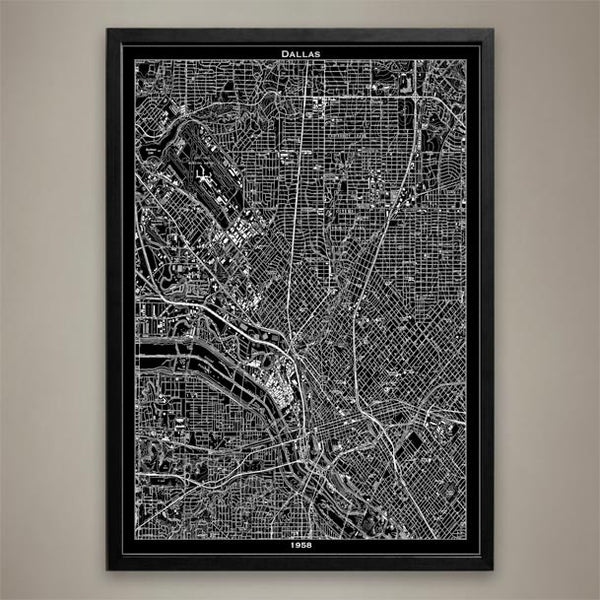
Map Print, DALLAS
$29.00
Dallas, Texas is big, bold, and bright and this map of Dallas expertly details each and every side street that makes it so. In a state where everything is bigger, this city map poster scales down the streets so that you can enjoy viewing what Dallas looked like in 1958. While Dallas, Texas is currently the fourth largest metropolitan in the state, it wasn’t also such a large city. The humble roots of Dallas, Texas are recreated using premium cardstock and archival ink so that you can look back on where the city has been and fantasize about where it will go next.
The purchase of this listing is for one Dallas city map print with the following specifications and options:
Style: Map of Dallas, Texas (Circa 1958)
Sizes available: 18 x 24, 24 x 36 or 36 x 48 inches
Colors available: Black or white
Materials: 100# premium card stock
Please note the purchase of this Dallas poster does not include a frame. Your map of Dallas poster will be mailed via USPS First Class and preserved in a durable shipping tube. If you would like to continue to shop for more Texas home décor, prints of cities, or map posters you may return to the GeoArtShed by clicking the following link:
http://www.geoartshed.com/collections/print-posters-city-maps
© Copyright 2013 GeoArtShed. Artwork may not be reproduced or resold.
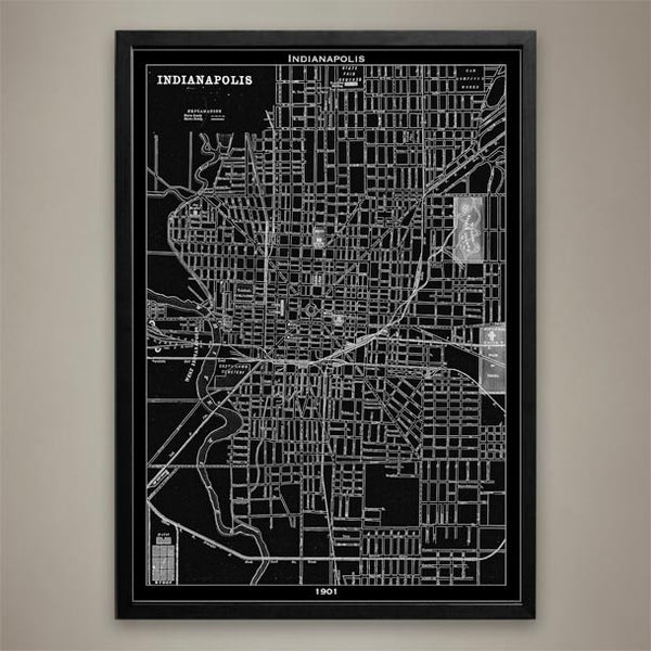
Map Print, Indianapolis
$29.00
INDIANAPOLIS Map Print, Black and White Indianapolis Wall Decor
Known as "The Crossroads of America" for its roads that lead to cities like St. Louis and Chicago, Indianapolis, Indianapolis became the state capital of Indiana and the county seat for Marion County. Indianapolis is also known as the city that rivaled Detroit. It grew to be a large automobile manufacturing city at the turn of the 20th century and kept up its status for many years. Our 1901 Indianapolis map is printed on premium archival stock with a 1/2 inch border around the poster's edge for easy framing. Hang this piece of history in any home or office wall. ————————————————————————
Vintage Map Print Sizes Available
18” x 24” $29
24” x 36” $63
36” x 48” $118
Frame not included.
© Copyright 2013 GeoArtShed. Artwork may not be reproduced or resold
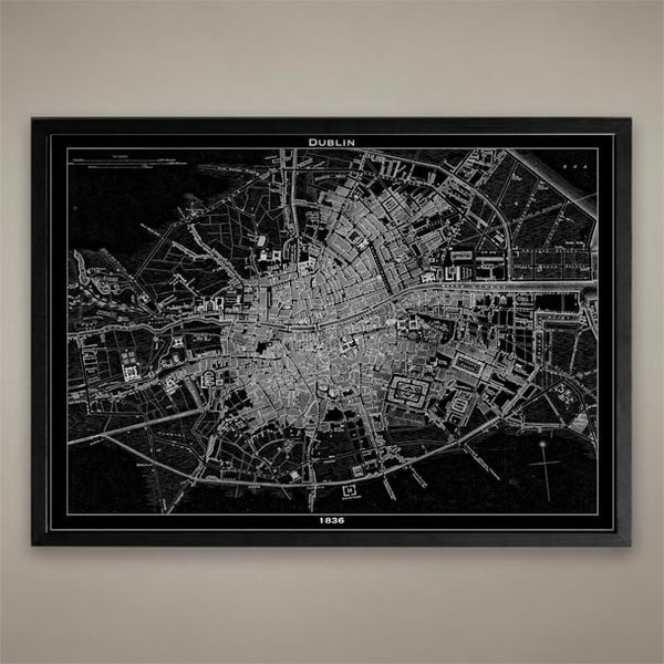
Map Print, Dublin
$29.00
Dublin, Ireland Map Print, Black and White Dublin Wall Decor
————————————————————————
Vintage Map Print Sizes Available
18” x 24” $29
24” x 36” $63
36” x 48” $118
Frame not included.
© Copyright 2013 GeoArtShed. Artwork may not be reproduced or resold

Map Print, SALT LAKE CITY
$29.00
Map Print, Salt Lake City
————————————————————————
Vintage Map Print Sizes Available
18” x 24” $29
24” x 36” $63
36” x 48” $118
Frame not included.
© Copyright 2013 GeoArtShed. Artwork may not be reproduced or resold
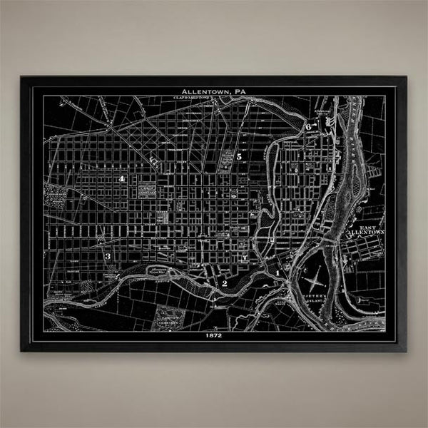
Map Print, ALLENTOWN PA
$29.00
Map Print, ALLENTOWN PA
————————————————————————
Vintage Map Print Sizes Available
18” x 24” $29
24” x 36” $63
36” x 48” $118
Frame not included.
© Copyright 2013 GeoArtShed. Artwork may not be reproduced or resold
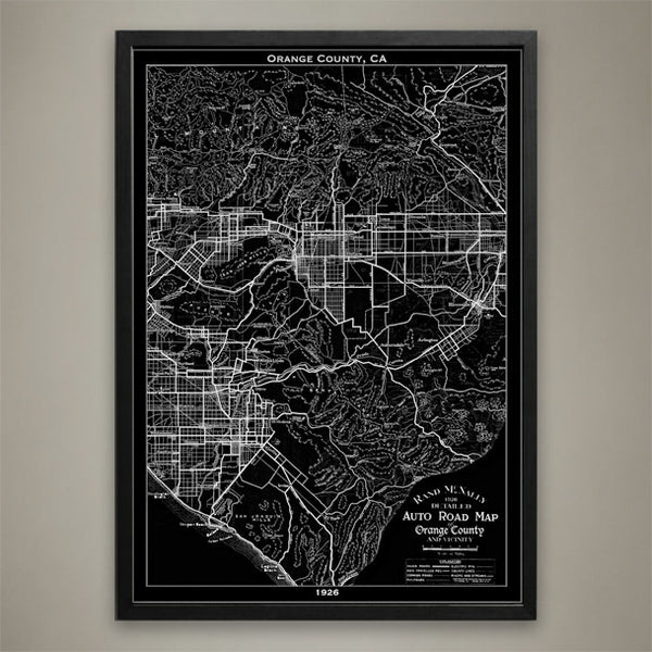
Map Print, ORANGE COUNTY, CA
$29.00
Map Print, ORANGE COUNTY, CA
————————————————————————
Vintage Map Print Sizes Available
18” x 24” $29
24” x 36” $63
36” x 48” $118
Frame not included.
© Copyright 2013 GeoArtShed. Artwork may not be reproduced or resold
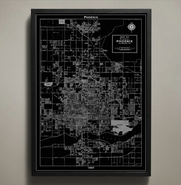
Map Print, PHOENIX
$29.00
Map Print, PHOENIX
————————————————————————
Vintage Map Print Sizes Available
18” x 24” $29
24” x 36” $63
36” x 48” $118
Frame not included.
© Copyright 2013 GeoArtShed. Artwork may not be reproduced or resold
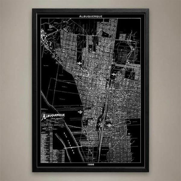
Map Print, ALBUQUERQUE
$29.00
Map Print, ALBUQUERQUE
————————————————————————
Vintage Map Print Sizes Available
18” x 24” $29
24” x 36” $63
36” x 48” $118
Frame not included.
© Copyright 2013 GeoArtShed. Artwork may not be reproduced or resold
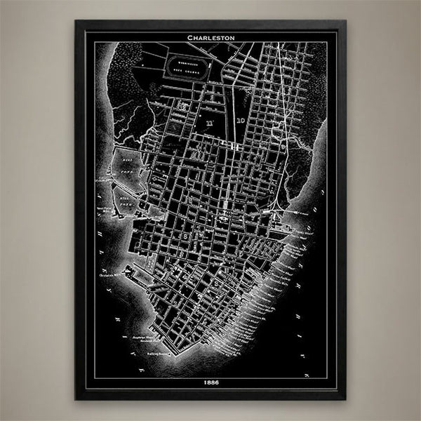
Map Print, Charleston
$29.00
Map Print, Charleston, SC
————————————————————————
Vintage Map Print Sizes Available
18” x 24” $29
24” x 36” $63
36” x 48” $118
Frame not included.
© Copyright 2013 GeoArtShed. Artwork may not be reproduced or resold